Changing Face of Norwich
- Redwell Street to St Andrews Plain
One of the many challenges facing the engineers planning tram routes through the City was how (and indeed where) to run the track between Castle Meadow and St Benedict’s. It is best illustrated by our first image from 1884 O/S map where the new link has been marked in orange. As can be clearly seen the planners didn’t let trivialities, such as buildings, get in their way. Although some building were lost as well as part of Garsett House, it did bring the medieval Suckling Hall back into view.

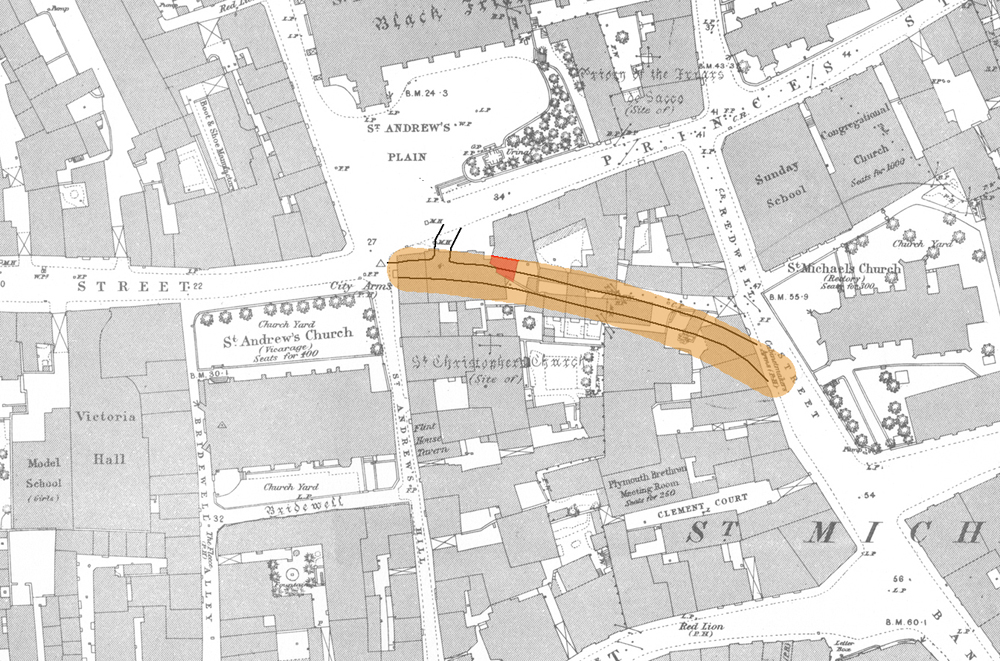
Cutting off a corner was no great concern for our late Victorian entrepeneurs. Simply knock down everything in the way.
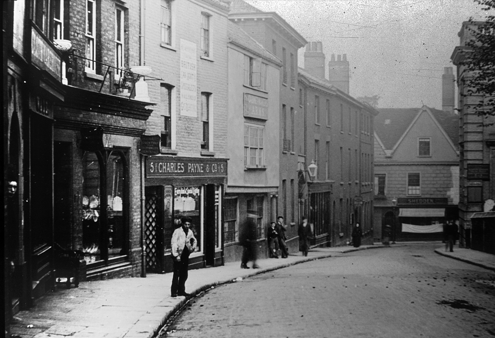
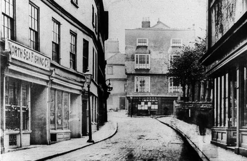
These pictures show the scene on Redwell Street before, during and after the reconfiguration.
We can clearly see that number 5 is occupied by Charles Payne & Co, who we know from trade directories were gas and hot water engineers.
We can then just make out that its neighbour at number 6 is the Cabinet Makers Arms,
which stands next door to an imposing three-storey building which was the home of the rector of the nearby St Peter Hungate (Princes Street).
Numbers 6 and 7 were demolished around 1898 to make way for the track which ran in a huge curve linking Redwell Street and St Andrew’s Street.
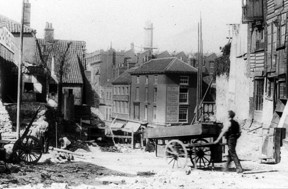
Our work in progress image, looking from the direction of Redwell Street down St Andrew’s Street towards the Festival House pub, shows the devastation wreaked in the name of progress.
It is interesting to see the basic equipment used by the workmen.
Also note in the background a huge factory building which housed Harmer’s clothing factory (now the approximate location of St Andrew’s car park).
This building wasn’t destroyed by the City’s planners, but by the Luftwaffe.
The second picturesque image, which looks somewhat posed, shows the scene after the alteration.
We can clearly see both the tram track and the overhead wire. What is less clear is the fact that number 6 was rebuilt and extended.
The license from the Cabinet Arms was then merged with the license of the City Arms (which had previously been located on St Andrews at the other end of the new track and had been demolished at the same time).
The new premises, also called the City Arms, traded on until 1958 after which it was removed to make way for the Eastern Counties Newspapers grand new edifice, which today houses the University College of the Arts.
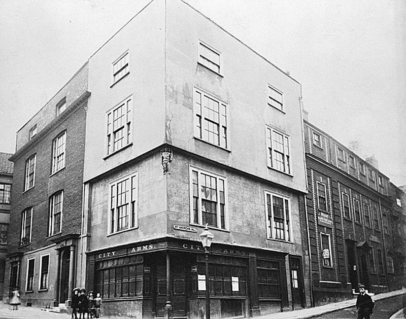
Thist image shows the streetscape before the building of the tramlines – an area soon to be subject to significant change.
The imposing 16th-century four-storey building jutting onto St Andrew’s Plain was the home of the City Arms pub owned by Lacons of Great Yarmouth.
Behind the City Arms we just get a glimpse of Garsett House formerly known as Armada House. Built around the same time as the City Arms,
this Tudor building survived the trams, though it did have the misfortune to lose part of its south wing, leaving it slightly misshapen.
Less obvious was the slight alteration made to St Andrew’s Churchyard, where a small piece of land was lowered.
Builders working here are reported to have collected seven basketfuls of human remains from the site.
The Norwich Electric Tram Company had paid £2573 for the C'ity Arms premises, a popular venue largely used by ‘musical people, fishing clubs and other societies’.
An application to open a new public house on the corner of St Andrew’s Hill and the new cut through was rejected –
largely on the grounds that there were already nine public houses within a radius of l00 yards and a staggering 19 within 150 yards.
Instead, as noted previously, the licence was merged with the Cabinet Makers Arms (Redwell Street) and transferred to a new premises.
Despite the destruction wrought on this area, one positive aspect of the street reconfiguration was that the medieval Suckling Hall was brought into view.
Though over the years it has been subject to many renovations, the oldest surviving parts of this former merchant’s house date from the early 14th century.
Of course, it is now the home of the popular Cinema City.
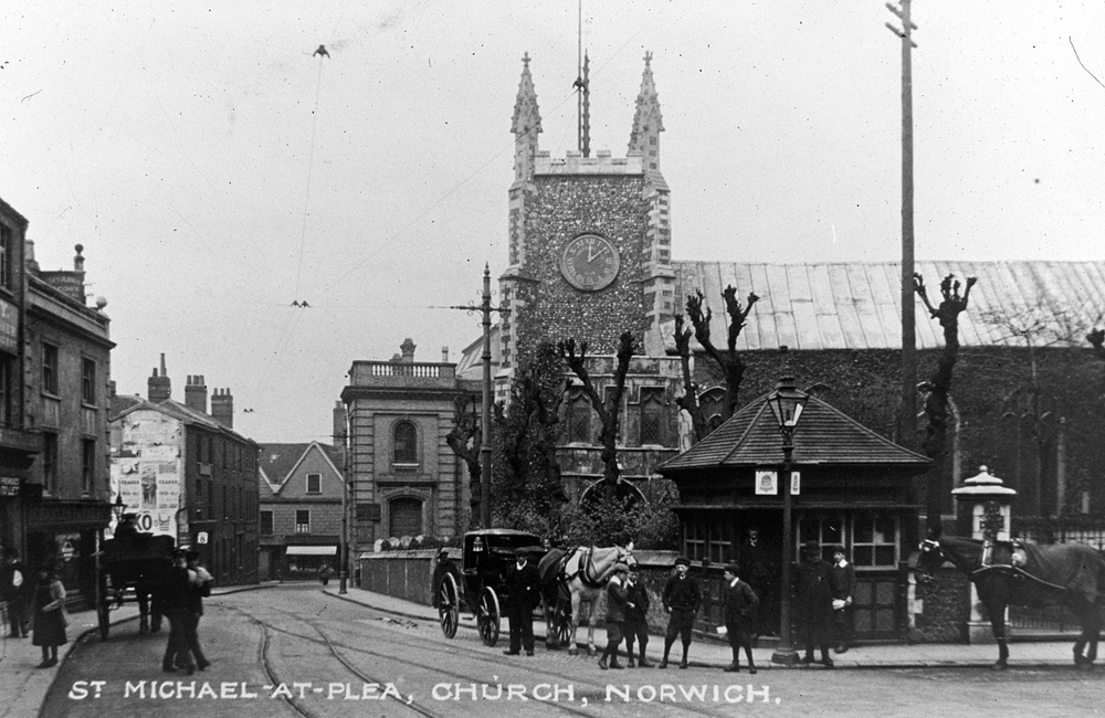
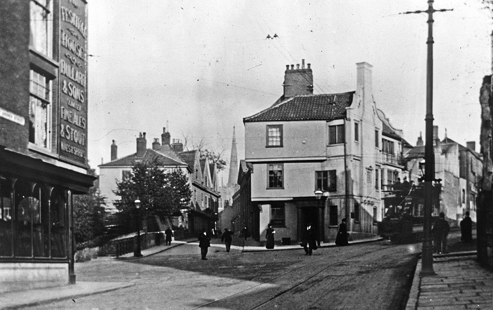
This image shows an attractive scene after the work was completed. A view that is still recognisable today.


