Frances &
Michael
Holmes
Maps are used by most of us as a directional tool – an illustration of how to travel from A to B. But maps of a single area drawn through the centuries do much more than that. They are snapshots of a specific place at a specific time which can be used to form the bedrock of the story of how an area has developed. Sometimes they raise questions, but they also give answers.
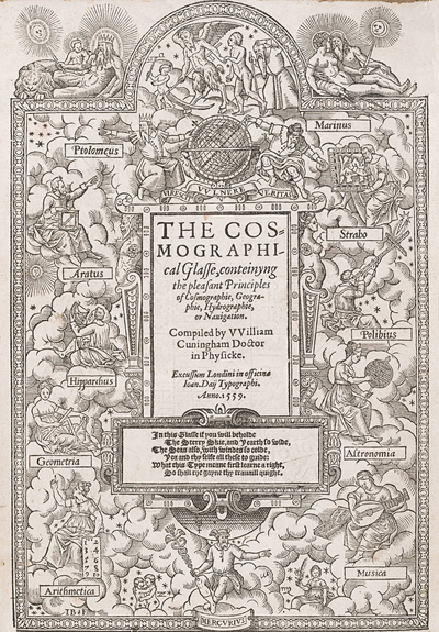
The earliest surviving complete printed map of a provincial town is actually of Norwich. Produced in 1558 its author, William Cuningham, making use of the modern technique of triangulation - originally using church towers in Norwich Wymondham and Swardeston - to fix the location of other sites within this triangle. Cunningham’s map appeared in a large book entitled The Glass of Cosmography (1559). Containing a mixture of poetry, geometry, geography and pieces of classical literature. As a result, we have a detailed view of Tudor Norwich in the mid-16th century.